iphone and Apps
Moderator: Club Moderators
-
colin keightley
- BHPA Club Coach

- Posts: 2483
- Joined: Fri Oct 12, 2007 5:22 pm
- Full Name: Colin Keightley
- Location: Stockton
- Contact:
Moe ppsa
Memory Map is now available as an app on the iPhone. £19.99 gives you the app and OS Topo map credits for the UK.
The CAA maps are available to download from PC or via Wifi aswell.
Met Office now have an app aswell.
Motion X has been updated.
Foreflight is good if you ever intend flying in the USA. Full VFR charts available as is airport info.
Enjoy!
The CAA maps are available to download from PC or via Wifi aswell.
Met Office now have an app aswell.
Motion X has been updated.
Foreflight is good if you ever intend flying in the USA. Full VFR charts available as is airport info.
Enjoy!
You are only as good as your last flight........
Memory map
According to this thread
http://forums.flyer.co.uk/viewtopic.php ... 77&start=0
memorymap have waved s big stick and apple removed QCT Viewer from the app store. This app let you download all old memory map maps to the iPhone.
Memory map now want £20 and QCT was only £5.
The new CAA electronic charts are in a new format qv3 or something. I wouldn't rush out and buy memory map just yet until you can be sure you can run old and new maps on the iPhone.
My main problem is using flight logging and map display at the same same time. Motion X seems to work in the background but skylogger won't and that has full IGC G Rec data for comps.
Top Tip!!!!!!!!
To solve the problems if using an iPhone with gloves on I m told cocktail sausages do the trick!
Just gaffs tape a sausage to your gloves and hey presto you can call Gary Stenhouse and tell him you re flyin with your pinkies still warm in gloves.
Technology is a beautiful thing!
You are only as good as your last flight........
-
colin keightley
- BHPA Club Coach
- Posts: 2483
- Joined: Fri Oct 12, 2007 5:22 pm
- Full Name: Colin Keightley
- Location: Stockton
- Contact:
-
Martyn Wimpenny
- Mingling
- Posts: 82
- Joined: Fri Mar 19, 2010 4:12 pm
- Location: Sunderland
Iphone Rock
apps at 1.99 can't be bad - the I vairiomter os very good, the wind speed app is excellent - more accurate than some anamoeters.
Regards
Martyn
Regards
Martyn
Apps
The memory map app is £19.99 not £1.99 and by all accounts is crap if you believe the feedback on the apps store.
I wouldn't try using the Ivario as a vario. It works for a few seconds then still gives a +ve climb even when stationary. The motion x and skylogger/tracklog apps are better and you can put your flights onto the xc league/club league.
The windmeter averages heavily and does not read gusts/lulls. It's got it's uses.
I use motion x to view my flights and to log. I can make waypoints of takeoff along with a picture of it( good for landing fields) and see how high/ far/ fast I went. It's certainly better than the crappy garmin I used to use
For Coastal flying try xcweather app and marine day tides.
I think Colin put links on for most apps.
You are only as good as your last flight........
Notams
There is now a NOTAMS app for the Iphone. This could be very useful but until i know more I won't be buying. Price is £3.50 I think.
Hopefully it does exactly what it says on the tin.
Hopefully it does exactly what it says on the tin.
You are only as good as your last flight........
-
colin keightley
- BHPA Club Coach
- Posts: 2483
- Joined: Fri Oct 12, 2007 5:22 pm
- Full Name: Colin Keightley
- Location: Stockton
- Contact:
Havnt had much luck with skylogger so far keeps giving rediculous altitudes and the trace isn't always accurate I still use it but I use the garmin also so when I download it I have a backup the garmin is always very accurate it just doesn't do altitude, I havnt used motion x in the air yet but have noticed it appears to be more reliable than skylogger, on the ground anyhow, still early days yet and I'm sure these will improve.
Glenn are you flying the LCC this year if so how do you plan on using your iPhone as Gps considering you need to mail your flight logs from the phone
Glenn are you flying the LCC this year if so how do you plan on using your iPhone as Gps considering you need to mail your flight logs from the phone
If Acro was easy they'd call it Cross Country
07824 554735
Livetrack24: Colinkeightley
07824 554735
Livetrack24: Colinkeightley
Skylogger
Hi colin!
I tried to use the skylogger in Spain. Was having none of it. If you don't update position as you go it takes ages to aquire a fix. Motion x did this at first but if you log in to any free wifi at your location it prompts motion X to look for the best set of satellites to give a fix.
The altitude accuracy can be off as you have found. With Motion X you can see how good the satellite fix is. The most accurate it can be is to 15m. I m not sure how many channels the receiver has and I doubt it has WAAS to improve position accuracy.
I might do the LCC but would want to improve my flying before entering this year. I would use my Garmin as it's easy to load waypoints etc back with Calvo.
The Garmin does not have full topo moving map and easy waypoints entry.
I like being able to post flight logs straight to email or Facebook (check my news feed ).
I m gonna check my alt log against the log on my vario to see how out it is.
You are only as good as your last flight........
-
colin keightley
- BHPA Club Coach
- Posts: 2483
- Joined: Fri Oct 12, 2007 5:22 pm
- Full Name: Colin Keightley
- Location: Stockton
- Contact:

memory map
hiya Brian,
Is memory map just a viewer or does it do full moving map with waypoints and groundspeed/heading/alt etc?
V1.0 only got 1 star from most reviewers which is pretty crap for a £20 app. V1.2 is getting 5 stars but reading the reviews they are almost like " wow I can see maps on my phone. Cool!" Which isnt exactly the kind of recommendation I would listen to.
So being a trusted pillar of society I would like to hear your thoughts on what it actually does and doesnt do.
Currently with Motion X I can tap the map for waypoint entry see groundspeed, track, ETA, Alt etc and my track on the topo maps I got via wifi/3G.
If MemoryMap can do all that plus display the CAA maps then I'd buy it.
I viewed my track from Mont Cab on Google Earth and it's very accurate interms of its track. Havent checked Altitude accuracy though which I know can be a bit daft at times. On approach to land I caught a thermal and had to S turn off the extra height just infront of 2 big trees. It's there on the Satellite view exactly as I remember. And I took some photos with the phone and call Nick for a lift back up.
You are only as good as your last flight........
-
colin keightley
- BHPA Club Coach
- Posts: 2483
- Joined: Fri Oct 12, 2007 5:22 pm
- Full Name: Colin Keightley
- Location: Stockton
- Contact:
memmap
cheers for the info colin. Not been on the apps store for a while, only updated apps so not seen the freebie.
I've just loaded up Motion X to see exactly how daft the alt readout was and everything has changed. A big blue button now gives waypoint entry on the and the menus have been restructured. It's a bit weird.
But it now has glide related functions onthe track recorder page. Personally I would not use them though.
- Attachments
-
- motion1a.JPG (39.29 KiB) Viewed 29454 times
You are only as good as your last flight........
iphone gps compass
new compass page
- Attachments
-
- mot2a.JPG (33.72 KiB) Viewed 29452 times
You are only as good as your last flight........
moving map and track
The moving map is great if you have quick wifi to download the maps with. I've got the lakes, dales, N Yorks, East coast and the NE Sink Hole (cheviots) loaded as well as Algo and Alicante areas. The maps are free topo maps.
Needed more zoom levels to 16/16 but did not have the time or space to do it for Spain.
Would like to see Speed, Alt, Compass pointer and possibly ETA on the map page.
Needed more zoom levels to 16/16 but did not have the time or space to do it for Spain.
Would like to see Speed, Alt, Compass pointer and possibly ETA on the map page.
- Attachments
-
- mot3a.JPG (39.39 KiB) Viewed 30355 times
You are only as good as your last flight........
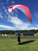
thats what this looks like in real life
thats what this flight looks like. The take off and landing areas are PRIVATE. Club members only
Not for internet trawlers to see and just rock up and upset the locals/farmers. Don't lose it for the guys in Alicante.
PHOTO CREDIT: NICK at Doyouwanna.net
Not for internet trawlers to see and just rock up and upset the locals/farmers. Don't lose it for the guys in Alicante.
PHOTO CREDIT: NICK at Doyouwanna.net
- Attachments
-
- montcab.jpg (22.12 KiB) Viewed 30351 times
You are only as good as your last flight........
-
colin keightley
- BHPA Club Coach
- Posts: 2483
- Joined: Fri Oct 12, 2007 5:22 pm
- Full Name: Colin Keightley
- Location: Stockton
- Contact:
-
colin keightley
- BHPA Club Coach
- Posts: 2483
- Joined: Fri Oct 12, 2007 5:22 pm
- Full Name: Colin Keightley
- Location: Stockton
- Contact:
-
Bradleisure

- Chatty
- Posts: 423
- Joined: Sat Mar 22, 2008 5:53 pm
http://www.freethinker.com/iphone/livet ... index.html
Now has airspace via OpenAir
Clients for other phones don't know if they have airspace.
Get those battery packs ready!
Now has airspace via OpenAir
Clients for other phones don't know if they have airspace.
Get those battery packs ready!
Fly Safe & Fly Far 

igot the iphone
Well, I got one.
Now I have loads of questions for any of you who have been using one for a while.
1. I downloaded MotionX. Looks good. Now I'm downloading loads of the topo maps to use with it. Takes forever. Any advice on using it would be appreciated. Can we get a valid IGC file from it? From this thread, it looked like we can only get a IGC file from skylogger. Which I've not downloaded yet. Is this correct?
2. I have the PC version and mobile PC version of Memory Map which I think is too expensive to go and buy the iPhone version (£12.99?) plus additional maps. Especially when you can't get a valid IGC file MM. What do you advise?
3. Lastly, battery life sucks on iphones. There is a good video on Youtube about how to extend the battery life - basicly go to settings and shut off everything you don't need (bluetooth, GPRS, wifi, and more). I researched loads of different hard cases with rechargeable batteries for the iPhone. Most of them are very expensive.
Here's a few if you're interested:
EnerG Slim-Fit Extended Rechargeable Battery Case for APPLE IPHONE 3G and 3GS
http://www.amazon.com/Slim-Fit-Extended ... pd_sim_e_1
Back-Up Rechargeable POWER Boost for iPod, iPhone 3G / 3GS, ALL BlackBerry's, Kindle 2 & Kindle DX - Refuel 3 Ways AC, USB and SOLAR
http://www.amazon.com/Back-Up-Rechargea ... d_sim_MI_1
New Trent IMP130 Slim-Fit Extended Rechargeable Battery Juice Case Air for IPHONE 3G and 3Gs
http://www.amazon.com/New-Trent-Slim-Fi ... =pd_cp_e_1
http://portablepowersupplies.co.uk/usbl ... lAodDD8y-A
£30
Case-Mate iPhone 3G Fuel Rechargeable Battery Pack
Powerskin.co.uk £50
http://www.safpwr.com/iPhone-Battery-X-type
$69
I'm trying to decide between the casemate for about £40 and the protapow for £30 (can use it to recharge other USB devices), but then I'd need to buy a protective case (like otterbox) in addition to that.
My main question in this post is, what do you use to extend the battery life of your iphone?
So, any additional comments on this thread would be helpful.
iPhone batterys are crap
The battery life isn't great that's true. I guess it's to do with the amount of programs and types of connection running simultaneously.
Switching off 3g and roaming plus wifi and Bluetooth go a long way to extending battery life as does closing down any open accounts ie email , forums , facebook etc that will try to use Internet access for regular updates. Try to power the iPhone off the cars 12v cig lighter when in the car helps also.
Motion x topo maps can take a while even via wifi. But hey at least they are free! If you want more detail it will take longer and use more memory. Set your motion x to glide via the menu and it becomes very accurate but altitude is still way , way off reality and they should really get that sorted. All it needs is a means of calibrating or zeroing not just Reading out that I was at 700ft amsl when I m on a dune at blackhall about to take off.
Ask brian day about memory map. He has it installed. Skylogger takes ages to get a fix but does do igc. To convert your motion x track email it to yourself via the share function then drop that file into gpsbabel to convert to igc. The more people that contact the makers of motion x to add igc and more accurate altitude info the more likely they are to do it.
See the links page for some more apps.
You are only as good as your last flight........
-
colin keightley
- BHPA Club Coach
- Posts: 2483
- Joined: Fri Oct 12, 2007 5:22 pm
- Full Name: Colin Keightley
- Location: Stockton
- Contact:
Put my suggestions in with Motion X last night and was surprised how quick I got a reply
Motion X wrote:Hello Colin,
Thanks for your feedback, I'll let the MotionX team know that you're interested in exporting in IGC format, and airmaps as well. We love hearing suggestions so we can continue to improve MotionX-GPS, so let me know if you have any further thoughts.
In the meantime, you can try a converter such as GPSBabel to convert our gpx output to igc. It seems converted files can't be used for competition scoring or other official claims, though.
Best regards,
Juniper Nichols
Fullpower Technologies, Inc., makers of MotionX
juniper.nichols@fullpower.com
If Acro was easy they'd call it Cross Country
07824 554735
Livetrack24: Colinkeightley
07824 554735
Livetrack24: Colinkeightley
Battery power
Colin Chapman recommended an additional battery pack that plugs in to the iPhone via an iPhone lead and extends the phones useable life to 12 hours. They are eBay for £24.99 but I ve also found these with 4AA batteries from £8 upwards.
http://www.ilounge.com/index.php/review ... -and-ipod/
do a google search for the griffin tune juice 2.
I wrote to fullpower about igc on the iPhone aswell it would be great if they could do it.
http://www.ilounge.com/index.php/review ... -and-ipod/
do a google search for the griffin tune juice 2.
I wrote to fullpower about igc on the iPhone aswell it would be great if they could do it.
You are only as good as your last flight........
More power to ya
Or try find this one
http://www.ilounge.com/index.php/review ... wer-packs/
seems like you could potentially do a 160km XC and still have power to call for a retrieve.
http://www.ilounge.com/index.php/review ... wer-packs/
seems like you could potentially do a 160km XC and still have power to call for a retrieve.
You are only as good as your last flight........
USB power supplies
You are only as good as your last flight........
SAT NAV for £6
N Drive UK and Ireland full moving map sat nav for the car or bike for only £5.99. Cheap at twice the price!
You are only as good as your last flight........
trying out different apps
Hi,
I'm trying out different apps. I've got:
Motionx - which I like so far.
iMapMyFitness - eh, ok.
and just downloaded the free version of Memory Map.
But I've found a new one that looks good and can export an IGC file called livetrack24lite:
http://itunes.apple.com/gb/app/livetrac ... 21792?mt=8
I haven't downloaded it yet and there are no reviews. There is a PDF manual for it at:
http://www.freethinker.com/iphone/livet ... manual.pdf
which I haven't read yet.
Any thoughts?
Brian
PS- Glenn, how did you get screen shots off your iPhone?